Grand Canyon: South Kaibab Descent to Phantom Ranch With Bright Angel Ascent

Hike Report: Grand Views Spoilt by Noisy Crowds

Distance: ~16-17+ Miles (17.7 by my Garmin)

Elevation Loss & Gain: 4,700

Difficulty: Strenuous/hard due to distance, elevation change, sun exposure, heat

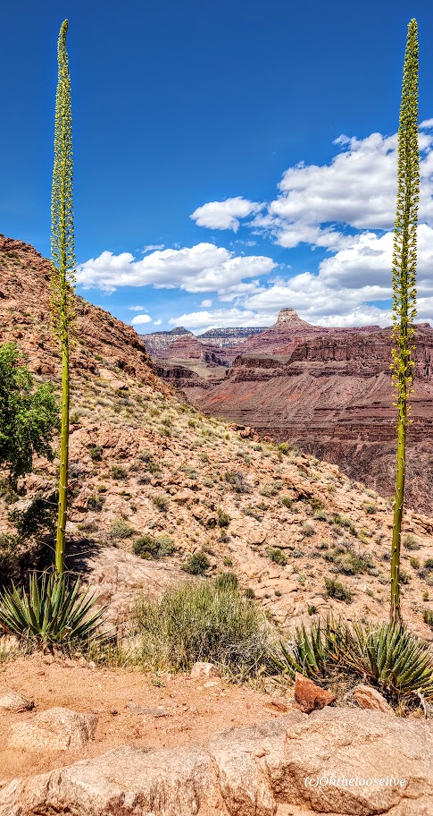
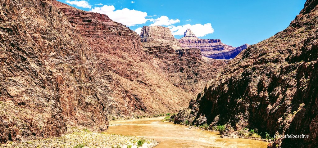
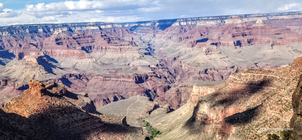
Grand views, but hiking the Grand Canyon is a bit of a circus. There are so many (way too many) people on the trails. It really detracts from the experience. (I’ll state the unpopular opinion that they should permit this hike, N.Rim, and Rim-to-Rim.)

I’ve been hiking (lengthy elevation gain hikes) and working out regularly (in anticipation of a possible Rim-to-Rim hike next month). This loop was an excellent training challenge. I have knee “issues”, so I wore knee braces. Fortunately, my knees were fine all the way down to Phantom Ranch (7.5 miles).

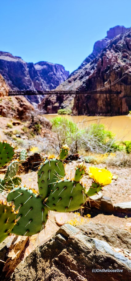
My hiking buddy and I arrived at Phantom Ranch after noon. We enjoyed two full 16-ounce glasses of refreshing lemonade (a must-do— $6 with a free refill!) I’d heard a lot about how cool Phantom Ranch is. It is a lovely, natural oasis with shady, gurgling Bright Angel Creek as backdrop and the comforts of campsites, rustic cabins, a restaurant, and a tiny store. Perhaps it’s charming when no one is around, but its charm was completely lost when I was there on an overrun weekend. The line for water refill there was at least 30 people long. I didn’t take any pictures at the ranch itself because I was so overwhelmed by the crowds

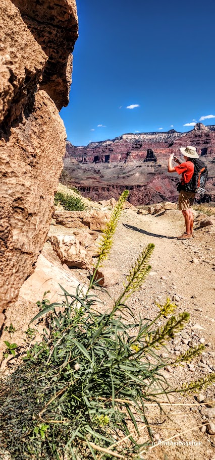
After downing 32 ounces of lemonade and a brief munchie break, we started climbing the switchbacks of Devil’s Corkscrew. By this time, the temperature was in the 90s. During the 3.5-mile climb up (1,300 ft), the completely exposed switchbacks, I slowed down, and my heart rate soared 20 points. By this point, my drinking water was the same temperature as my mouth. I couldn’t discern if I was drinking or if my Camelback Tube was twisted. Note, I was wearing a hat and a white shirt to deflect the sun’s rays. I don’t want to imagine what this section would feel like in triple-digit heat, which is common in the summer. I hadn’t acclimated to desert heat hiking yet because it was still Spring.

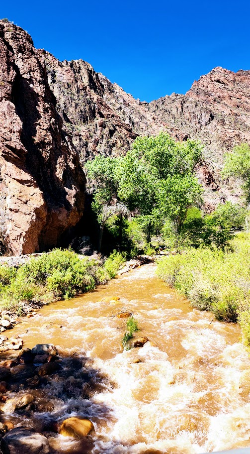
The second I came into the shade approaching Havasupai Gardens (water was available), my heart rate dropped 10 points. It returned to its active normal after I immersed my feet and my hat in the shallow stream. That immersion and the dragonfly below were the highlights here. We would have taken a longer break to wait for shadows to form on the steep Bright Angel Trail (4.5 miles, 3k elevation gain), but the area was completely overrun by noisy crowds. No pictures other than the dragonfly here, as I was too bummed out by the crowds. For me, it was the antithesis of a pleasant experience in nature.

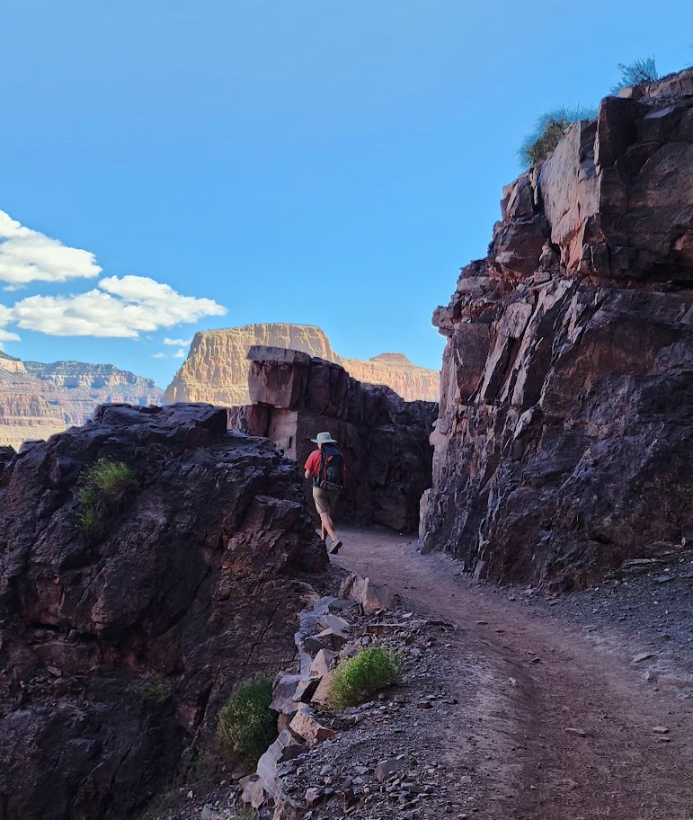
We left in a hurry, eager to put the crowds behind me. I felt stronger on the climb out than when I hiked North Kaibab to Manzanita Springs out and back. My knees started complaining about a mile and a half from the top—poles might have helped.

After enjoying a celebratory ice cream at the top, my friend and I decided to “walk” to the parking lot, adding another 2.5 miles. That was the straw that broke the camel’s back for me. At about the 2-mile mark, both of my legs viciously cramped and seized, throwing me to the ground and rendering me helpless for at least 5-minutes, and hobbled for the remaining half-mile and day. If that had happened on the way up, I would have been incapacitated and might have required assistance. Scary. Why did it happen? Hard to say, but likely due to dehydration and lack of electrolytes. I had trouble drinking when I was overheated because my water was hot. next time, if there is one, I will bring metal containers to keep the water/electrolyte liquid cool.

Notes: Don’t underestimate the challenges of hiking in the Grand Canyon North or South, or Rim-to-Rim, especially in the summer. Even without extreme heat to factor in, hiking here is a serious undertaking. Don’t overestimate your abilities. Get as much elevation and heat training in as you can. Know your limits, hike with a buddy, and be prepared with adequate water, water purifier, electrolytes, and food. I wore trail running shoes with good tread. I prefer lighter footwear to heavy hiking boots and like having my hands free. The trails are mostly well-groomed. I did not use poles, but I might take them if I do Rim to Rim. Since I don’t do well drinking warm water, I’ll take on the extra weight of metal containers for cooler water next time.

“END” Notes

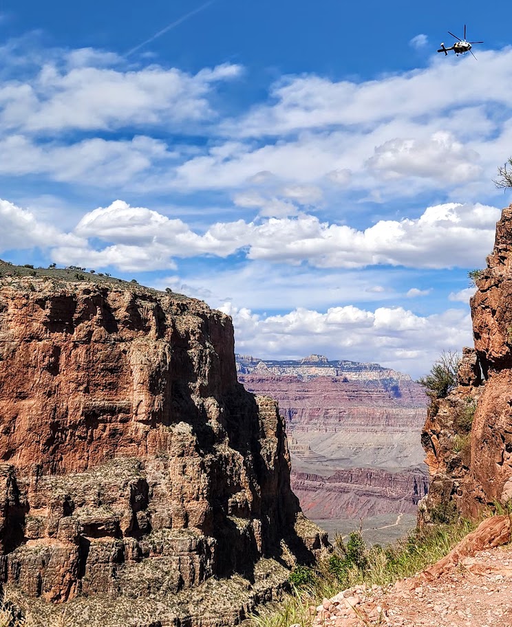
About a dozen people die in the Grand Canyon every year. The first cause of death is airplane and helicopter crashes (this comes in as first as it reflects the 128 deaths from the pre-FAA 1956 commercial airline collision). The second common causes are falls, jumps from, or driving off cliffs/ledges, and the third most common cause is due to the Grand Canyon’s extreme environmental hazards, including intense heat (temps can reach 120 degrees) dehydration/overhydration, cardiac arrest, flash floods, and lightning strikes.

Happy Trails & Safe Hiking!

Climbing Corkscrew Peak, Death Valley National Park, CA

Distance: ~8 miles

Elevation gain: ~3,360 ft

Difficulty: Moderate to strenuous, depending upon your fitness level (3k ft climb in ~2 miles). Class 2.

Corkscrew Peak (5,804 ft) is the imposing sentinel in the Grapevine Mountains of northern Death Valley National Park. It looks intimidating from afar and upon the approach, but the trail isn’t bad, and it’s a great workout. Definitely one of the most unique peaks I’ve seen.

Speaking of trails, the first portion requires some route finding. Head West from the Corkscrew Peak sign and follow the wide wash towards the peak. The route is cairned, gentle, and gradual, leading you to a narrow canyon area at about the 2-mile mark. Here, you’ll scramble up and out of the wash on the left. You’ll climb the spiraling rocky trail for the next 2 miles. Watch your footing, as there are many spots of loose gravel. All told you’ll be climbing 3,360 feet to the top—most of it packed into a somewhat intense 2 miles.

Right before you reach the top, there’s a cool natural window, a nice spot to return to enjoy a snack, and the view before the steep, slippery descent.

From the top, you’ll enjoy splendid views of Death Valley and surrounding peaks, including Langley, Whitney, and Telescope. You can also document your peak bag in the summit record, which is in a metal container wedged between some rocks at the top.

Getting there:

From the Visitors Center at Furnace Creek, drive ~ 11 miles N on State Highway 190 to the signed, paved Daylight Pass Cutoff Road toward Beatty, NV. Turn right and follow this road 10 miles to a signed road fork at Hell’s Gate. Go right onto Daylight Pass Road and drive 0.9 miles. Park on the dirt shoulder.

Notes: The initial section of the trail is a wide wash north of the road. The trail is slippery in sections with loose gravel “marbles; choose hiking or trail running shoes with the best traction. Some recommend poles for the way down. Personally, I do better on slippery downhill if my hands are free. It’s possible to trail run up, but be cautious on the way down.

Happy Trails!

Popular Pinnacle Peak for Panoramic Views and a Great Workout! Scottsdale, AZ

Distance: ~4 miles out and back

Elevation gain: ~1K (Trail high point is ~2,900 feet.)

Difficulty: Moderate to strenuous depending on your speed and fitness level.

Popular with locals and visitors alike, this trail is a great go-to if you’re in the area and have a limited window for a hike or trail run. You’ll be rewarded with panoramic views and a great workout. I enjoyed jogging the climb so much, I forgot to take pictures-lol, so you’ll have to come see the views for yourself. The trail doesn’t let you scramble to the actual peak, but tops out and then drops you down the other side.

Notes: Parking is free, but limited. Weekdays are less busy than weekends. Pinnacle Peak Park has a visitor center and restrooms, interpretive signs along the trail, and apparently rock climbing routes too. They offer fun activities as well, including moonlight walks, astronomy talks, yoga classes.

Getting there: 26802 N. 102nd Way Scottsdale, AZ 85262 · (480) 312-0990.

Spur Cross Ranch Conservation Area, Cave Creek, AZ

Distance: You choose ~2 miles to 19.7 miles

Difficulty: Easy to moderate, varies depending on the trail(s) chosen, length, and your fitness level

If you’re in the Scottsdale area and have time for a field trip, I highly recommend an excursion to Cave Creek. Hike the Spur Cross Ranch Conservation Area and enjoy the Saguaro “forest”, refreshing shaded creek-side trail, and if you keep your eyes open, you may get lucky and spot some petroglyphs too.

Choose your own adventure from 16 hiking and equestrian trails in this 2,154-acre area. My friend and I combined a couple of trails (Spur Crossing, Tortuga, and Dragonfly) for ~8 miles with ~1k of climbing. The terrain is mostly run-friendly.

After your adventure, head to town to quench your thirst, refuel, and shop in this blended authentic/tourist trap Western town that was settled in 1870.

Getting there: 29 miles from Scottsdale, via AZ-101 Loop N and N Scottsdale Rd44000 N Spur Cross Rd, Cave Creek, AZ 85331

Notes: Spur Cross Ranch Conservation Area $3 per person fee. Picnic tables and port-a-potties are available at the trailhead parking area.

We all scream for ice cream at the City Creamery

I had the best ice cream of my life at The City Creamery, home of handmade, small-batch ice cream in 16 favorites varieties and exotic seasonal flavors. (I’m not that much of an ice cream monger, but oh, my—delicious, chocolate infused with orange!) Also, their scoop portions are HUGE. However, I did manage to eat it all.

Happy trails!

Cheers from Stumbalina’s Cantina!

Sunrise Peak Via Sunrise Trail, Scottsdale, AZ

Distance: ~4.50

Elevation Gain: ~1,375

Difficulty: Moderate to strenuous, depending on your fitness level

Whether you go for dawn patrol or not, this hike will deliver a quick workout with great 360 panoramic views, seasonal wildflowers, and iconic Saguaro galore. Aptly named, this trail is rated the number 1 sunrise hike in Scottsdale so you may want to rise and shine for it. Several additional trails connect at the top to extend your adventure in the Sonoran Preserve Park.

Getting There: 2101 N. 145th Way, Scottsdale, AZ 85259. Trail parking is at the east end of Via Linda at 145th street

Happy Trails!