Adventures Near & Far, St. George Yoga & Hike Retreats, Popup Yoga, Local Guiding
Search Icon
Author: livevigorously
Greetings, I’m a St. George local who is passionate about blending my love for yoga, and the great outdoors to create an unforgettable experience just for you. Enjoy outdoor yoga (all levels) in an iconic setting and/or a guided hike to secret petroglyphs, caves, and slot canyons. With stunning Snow Canyon as my backyard, I'd love to be your guide to the best this area has to offer! Ask about my "home stay" options.
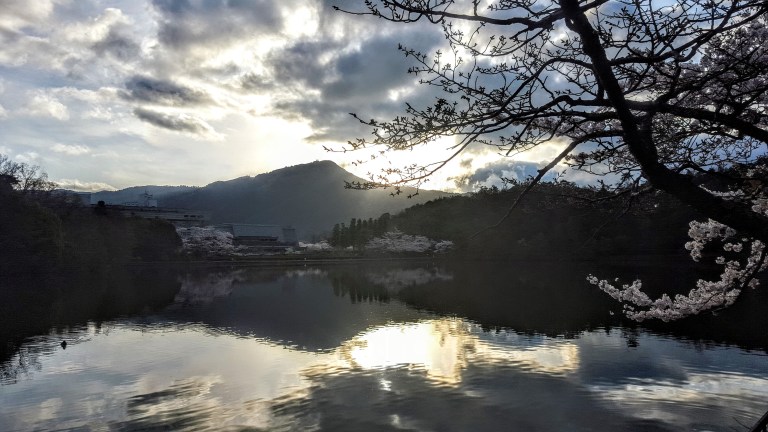
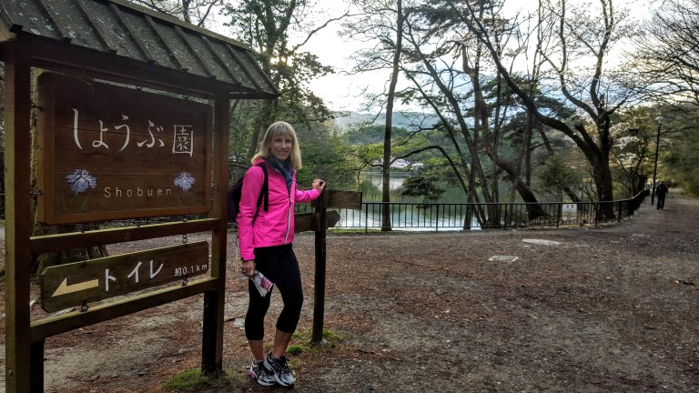
Takaragaike Park features a small, man-made lake with lovely trails that are laced with cherry blossoms in the spring. Though not a destination in and of itself, it’s great for a quick, refreshing nature fix or run if you’re staying at the Grand Prince Hotel Kyoto (made my top pick list) or attending a meeting at the Kyoto International Conference Center.
Convention center grounds
One of the more unusual sights I saw was a woman mediating in the park with a goose at her side. If you look closely in the top featured picture you can see them in the bottom left corner. The convention center is the large building in the background.
Apparently, there’s an iris garden here that I somehow managed to miss despite the obvious sign.
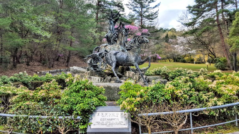
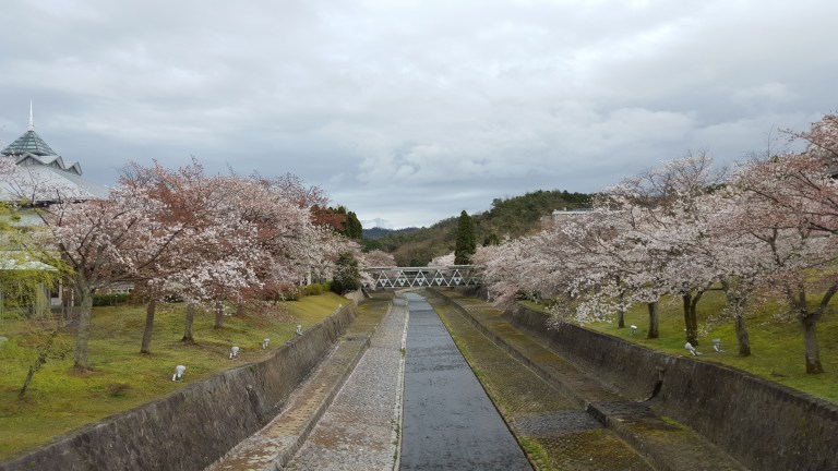
Some photos from my Kyoto walkabout – such a picturesque place!
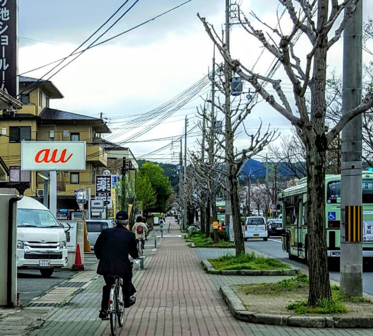
Bike paths and healthy lifestyles!
Temples and shrines
Kyoto life…
A day spent strolling anywhere around Kyoto is a day well spent. Beauty abounds and it’s all so wonderfully clean everywhere.
Getting to the park, convention center or Grand Prince: Kokusaikaikan Subway Station, on the Kyoto City Karasuma subway line, which is located right outside the north entrance to the park. It is also about 10 – 15 minutes north on foot from Matsugasaki station on the same subway line.
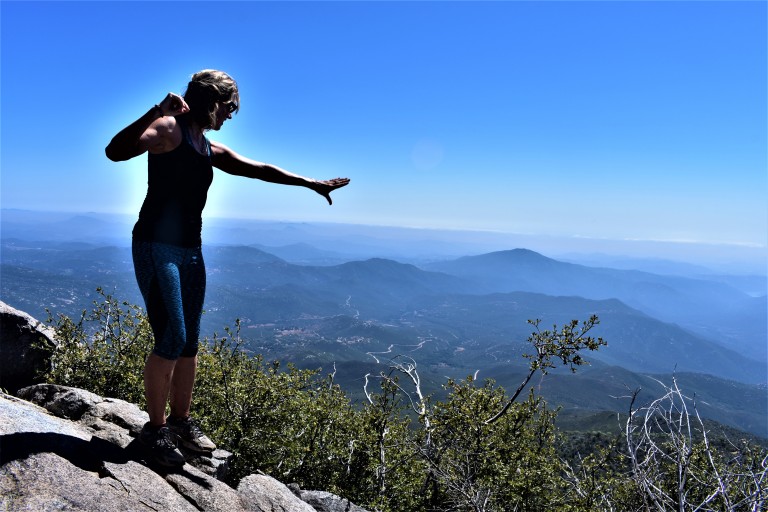
It’s relatively easy to “bag”the second highest peak in San Diego County as it tops out at just 6,515 feet. You’ve got a choice between two routes or a combo of them. I opted for the scenic trails up and took the paved road down to make a loop. Views were good on both routes, but far more solace, solitude and wildflowers on the less traveled, natural trail.
In 2003, the Cedar Fire , California’s biggest wildfire (started by a lost hunter who lit a signal fire that burned out of control) decimated 290, 278 acres, including 90% of the Park’s 24,700 acres. The ravages from that fire are still rampant, but these formerly rich forest (oaks, willows, adlers, and sycamore tress, cedar, white fir, ponderosa, Coulter, sugar and Jeffrey pine) and meadowlands are slowly making a comeback. More than 100 bird species abound in the park, including acorn woodpeckers, northern flickers and red tailed hawks, Mammals you might encounter here include gray fox, badger, bobcat, mountain lion and deer.
Azelea Glen Loop Trail
If you reach this sign, refill you water at the spring, but you want to turn back and follow the fireroad about a 1/4 mile to the Coneja Trail connector and take that on up to the peak.
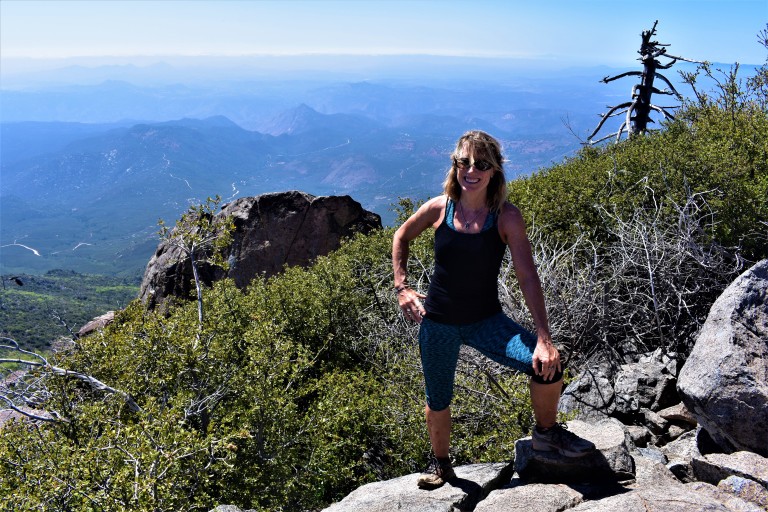
At the top
Unfortunately, it wasn’t a clear day so the Salton Sea and Anza-Borrego Desert to the east and Pacific coastline to the west and all the mountain vistas surrounding were a bit difficult to discern.
Is it just me or does the burnt tree in the picture above evoke an Indian chief bowing his head? (Kumeyaay Indians occupied the Cuyamaca mountains from antiquity until around 1857.)
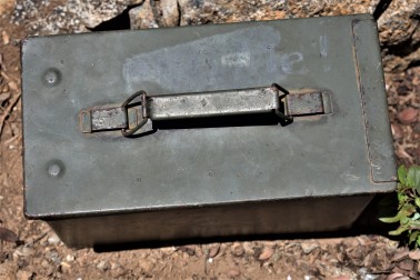
You can document your peak bagging effort by opening this box and signing in.
Views to Lake Cuyamaca and the Valley belowA framed view of Stonewall PeakA closer view of Stonewall Peak
There are plenty of other trails to explore nearby including a switchback trail up and down alluring Stonewall Peak (4 miles rt) and hidden waterfalls somewhere…(I’ll let ya know when I find them.) If I’d had more time I would have done Stonewall too. (The trail head is right across the campground entrance.) There’s more than a 100 miles of trails for hiking, horseback riding and a select number for mountain biking here. I’ll be back.
Planning your excursion
You can make a day or a weekend of your Cuyamaca adventure. The historic gold mining town of Julian is a mile or two away with its quaint shops, B&Bs, restaurants and famous pies.
Notes
Miles: 7.7 miles rt (Or just 5 miles rt if you take the paved road both ways.)
Elevation: 1700 ft gain/ loss
My route: Azelea Glen Loop to Azalea Glen Road. Make a right on the Azalea Fire Road, a left on the single track Conejo Trail that comes up in a 1/4 mile. The Conejo Trail hooks up with Lookout Fire Road about a 1/2 mile from the top – the steepest portion.)
Terrain: Mostly sweet, soft terrain (as in trail runnable), until you get to the Conejo Trail. It’s gets a bit rocky and pesky for a while on there so watch your footing. (Another reason I chose the paved road downhill.)
Difficulty: Moderate. Depends on your fitness level and the route you take. The 1/2 mile incline at the top is tough, but it’s all quite reasonable. I brought hiking poles but did not bring take them on the trail and was fine. (I have bad knees.) It would be a bit relentless to take the paved road up. (I wouldn’t mind trying it on a mtb bike. Heard about some people who did on road bikes – that’s a little nutty. Took me 2 hours up and 40 minutes down – no running…
Trailheads: Both the paved Lookout Fire Road & the Azelea Glen Loop begin at the Paso Picacho campground, Cuyamaca State Park
Parking: $10 State Park Fee
Dogs: Only allowed on paved roads and must be leashed.
Camping: Paso Picacho campground has family campsites with tables, firepits, running water and bathrooms.
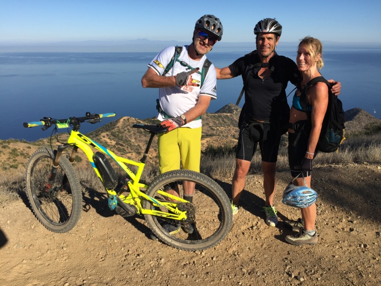
Like the man said, it’s all about the moments. Hans Rey specializes in collecting moments of exhilaration as he achieves epic mountain bike feats in amazing locations. The video of Hans and his two younger companions (Danny MacAskill and Gerhard Czerner) conquering Mt. Kenya andMt. Kilimanjaro on mountain bikes is spectacular. Hiking at elevation is hard enough, can’t imagine what it would be like with a heavy, awkward mtb on your back. Fifty-one year-old, mountain bike legend, Hans Rey shows us how it’s done and inspires us to dream big, rise to the challenges and treasure the moments.
(He was riding a electric MTB then, which I’ll admit I thought was just a tad lame…Got to please the sponsors I guess so I’ll give him a pass on that one.) Anyway, after seeing him slay Mt. Kenya and Mt. Kilimanjaro in 10 days, I think he earned a lifetime free pass to ride an ebike anytime.
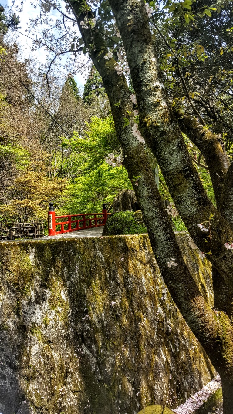
Kyoto is surrounded by mountains on three sides so the opportunities to hike abound. I haven’t been able to locate my trail notes on this one so I’m just going to post some photos from my Kyoto walkabout for now.
Sometimes your future
is clear and inviting. The
bridge appears; you cross.
Hmm…
Sometimes it’s hard to
know which way to go so let
the forest guide you.
Magical dappled light – must be the enlightened path
Find yourself in the
dazzling, dappled light-your path
to enlightenment.
Hidden shrines
Traditional buildings and cherry blossomsTemples
Never too far from civilizationSome signs are more helpful than others…Trail markers like this one at key intersections between Kyoto suburbia & Kyoto Forest trails were very helpful.
Most would agree that a trip to Kyoto isn’t complete unless you visit the Nishiki Market. Known to locals as “Kyoto’s Pantry”, the traditional, four-centuries-old Nishiki Food Market is a feast for the senses. The narrow, five block long shopping street is jam-packed with exotic (to the Westerner) items and approximately 130 food stands and restaurants. Bring your appetite to try something new for an unforgettable foodie experience. There are plenty of opportunities to taste samples or to buy snacks as you explore. Expect to be elbow to elbow with a big crowd of locals and tourists alike.
History
The origins of the market date back to around 1310 when it was established as a wholesale fish district. Over time, it evolved into the bustling kaleidoscope of colorful stalls, shops and restaurants that it is today.
This slideshow requires JavaScript.
Getting There
Less than a five minute walk from Shijo Station on the Karasuma Subway Line (4 minutes, ~$2 from Kyoto Station) or via Karasuma or Kawaramachi Stations on the Hankyu Line. The market is parallel to Shijo Avenue, one block north of Shijo Avenue in downtown Kyoto


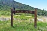 If you reach this sign, refill you water at the spring, but you want to turn back and follow the fireroad about a 1/4 mile to the Coneja Trail connector and take that on up to the peak.