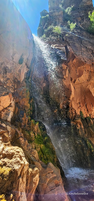
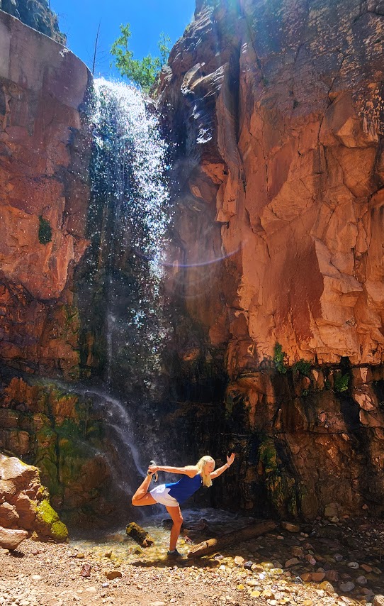
A short, shady stroll with some trail washout and a little scrambling at the end delivers a wonderful waterfall reward.
Great to top off another hike, take a roadtrip leg stretch, or have a lovely picnic spot.
Stay tuned for the videos.
Getting there:
The trailhead parking lot is located on the north side of SR-143, otherwise known as the Brian Head-Panguitch Lake Scenic Byway. Enjoy the entire scenic route if you can.
Challenging and strenuous ~16 Miles RT, including some sketchy scrambles, several slick rock traverses, and multiple MILES of exposed DEEP SAND SLOGGING. (Explains why no other humans are present.)
The scariest part was getting my phone wet despite it being in a dry bag and it blacking out. I feared the worst. Not really caring about the phone itself, but the prospect of losing all these hard-earned photos and videos!
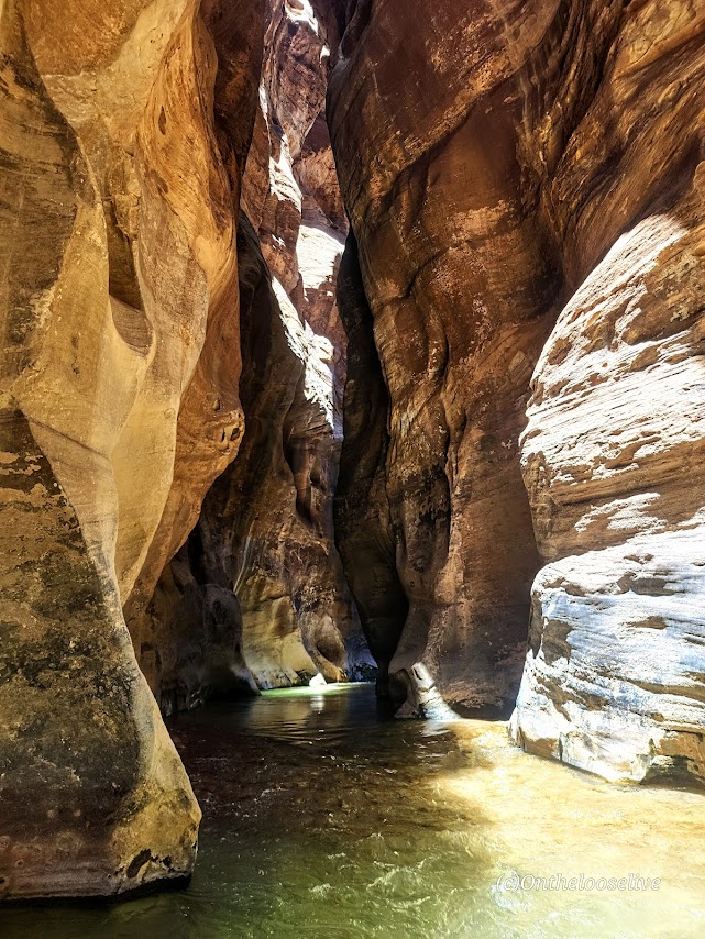
My bliss—splendid solitude and immersion in the sublime natural beauty!
Excellent navigation skills, a GPS, First Aid kit, water, and a water purifier are essential for backcountry adventures.
Lucky for me, one of my best hiking buddies is an experienced backcountry guide who is always prepared for every eventually, including me forgetting my water back at home in the fridge.
He always points me in the right direction.
Happy Trails!
PSA: It’s the season for heat exhaustion and heat stroke. Play it safe— avoid hiking in the heat of the day on exposed trails. Wear sun protection—sunblock, hats, and light clothes with SPF and bring plenty of water and a water filter!
Difficulty: Not easy- most rate it difficult and strenuous due to the distance, elevation gain, deep sand hiking, and exposure. Not for the faint of heart or sand-shy. Four-wheel drive to get to the trailhead is a must!
Elevation Gain: 1,581 ft
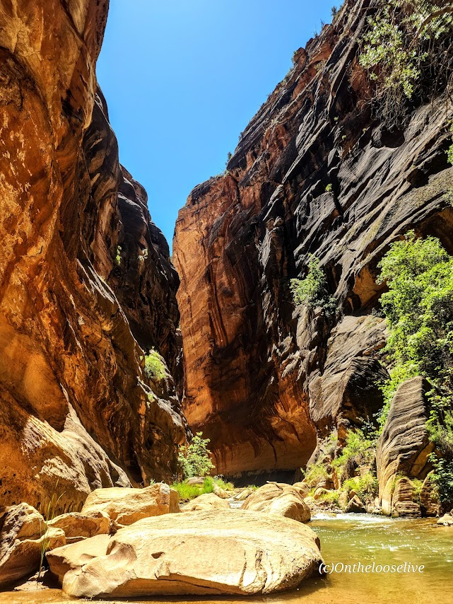
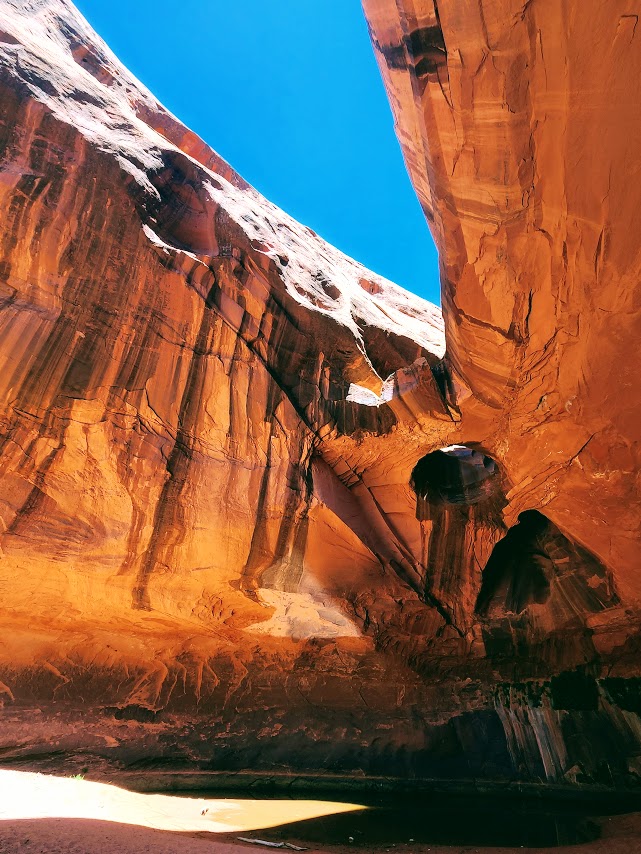
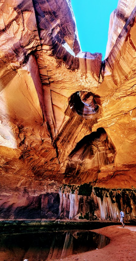
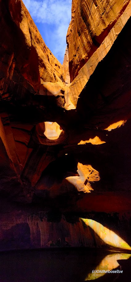
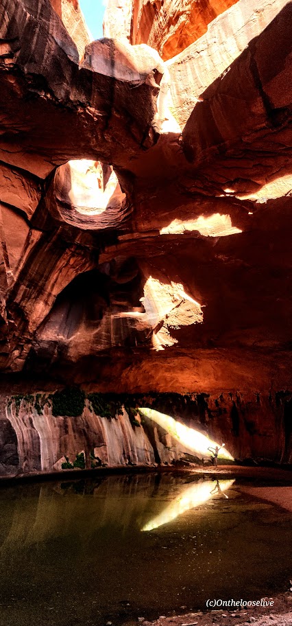
A well-hidden gem and one of the most dramatic and magical spots I’ve experienced in Utah. Well worth the considerable effort of driving nearly 30 miles of gnarly fire road and trudging through miles of deep sand. Almost the entire elevation loss/gain is in the first/last 2 miles. Imagine a deep sand slog, followed by a deep sand vertical climb, followed by a steep slickrock vertical climb, and you’ve imagined the final miles of the hike. About 80% of the hike is across exposed, arid desert, so take proper precautions! Dehydration, heat stroke, or worse, are real dangers, especially when the temperatures are high. Neon Canyon is susceptible to flash floods, so check your forecast before you go.
Navigation is a challenge as there is no trail per se. Cairns loosely mark the routes. Route finding, GPS, and backcountry skills are highly recommended.
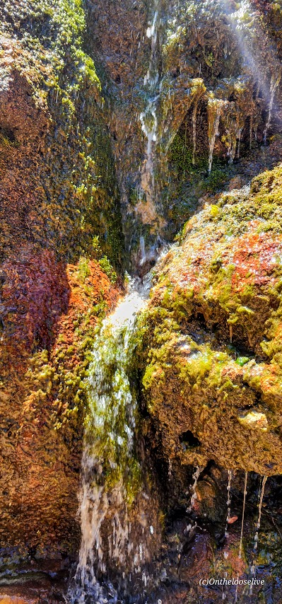
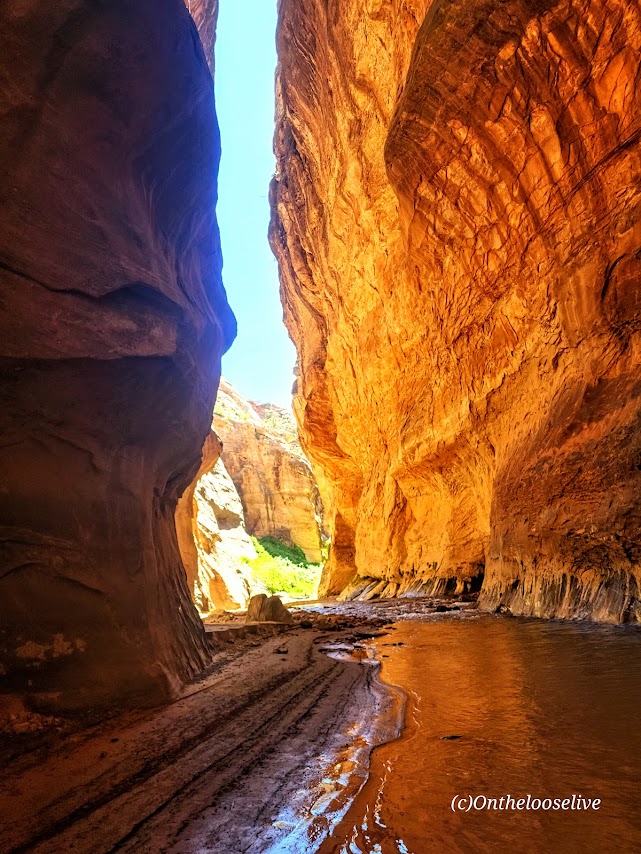
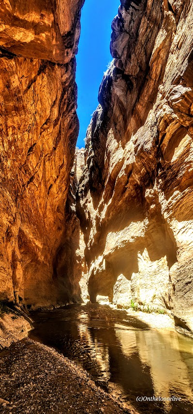
Check out the magical, mesmerizing reflections at the Golden Cathedral!
Fortunately, the tortuous 4-wheel drive to the trailhead and the deep sand slogging are great crowd deterrents.
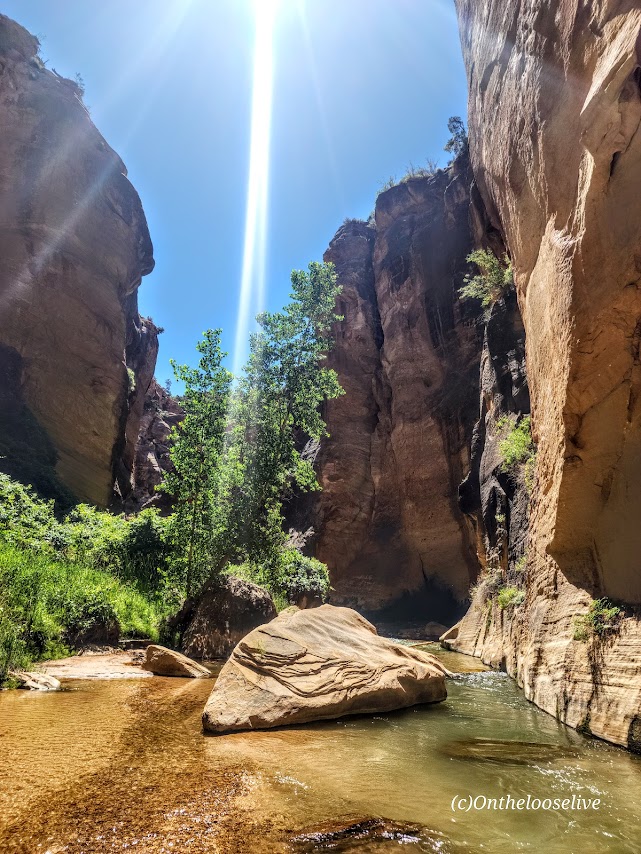
On my second visit to this glorious spot, the late afternoon light was dazzling and dramatic.
Getting there, if you dare: From Escalante, drive east on Hwy 12, and turn south/R onto the infamously gnaryly Hole-In-the-Rock Road. Take this unpaved rough road 16.7 tortuous miles and turn left at the sign “Egypt -10 miles”. Believe it or not, the road gets rougher from there. You’ll find the trailhead and its circular dirt parking lot on the left at the 10-mile mark.
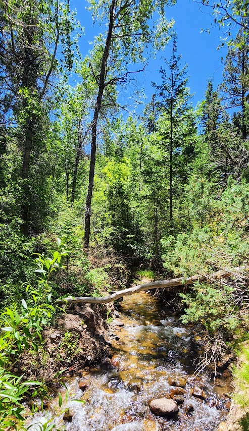
With its grand vistas, this short hike is lovely any time of year, but it is a special treat in the Spring when the wildflowers are blooming. I’ve never seen so many varieties in 1 hike! Note it can be a bit of a snow/mud fest in the winter.
Distance: 3.1 Out and back
Elevation: 636 ft
Difficulty: Easy to moderate depending on your fitness level
It’s been a minute since I’ve posted, I know. I’ve lost my mojo for it. It seems I’d rather be out in the wild adventuring versus reporting my adventures per se. Also, I’ve taken to off-the-beaten-path explorations, the kind that require a backcountry guide or advanced GPS and navigation skills to demystify. While my zeal for verbal show and tell has waned, I’ve become quite keen on photography. For now, my posts will be picture focused. Sorry, not sorry.
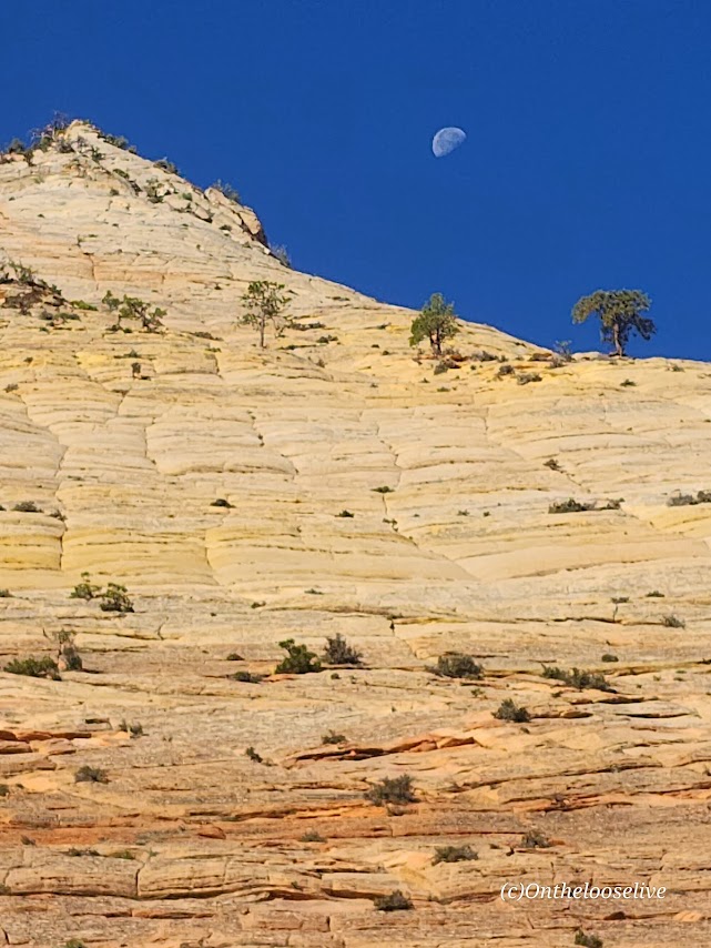
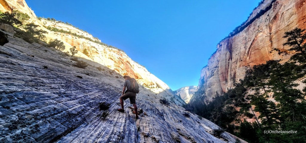
East Zion is magnificent, vast, and remarkably people-free. It’s also free of official trails, which makes navigation a challenge, except for those intrepid, experienced back-country types with finely honed navigation skills. This territory is not for families, recreational hikers, “tourons”, instaorons, or tikorons, if ya know what I mean. It’s potentially dangerous with hazards like quicksand and near vertical scrambling on slick slickrock with precipitous drops. Yep, you read that right—quicksand. “Did you see where little Timmy went?” Oops, that first step can be a doozy. I didn’t realize they had quicksand out here either. Not something you want to find out the hard way. Another reason to hike with a buddy and to have some kind of emergency alert system.
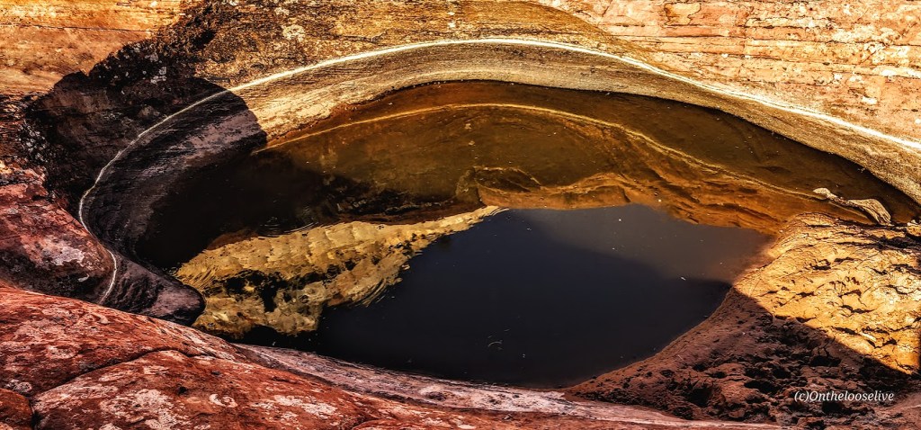
Sound scary? It should. It seems weekly, there are rescues and deaths in the ravishingly beautiful, but harsh playground of Southern Utah. A simple reflecting pool in a wash can turn into your worst nightmare. Quicksand can be lurking in the glistening sand next to a puddle in a wash like the one below. Your foot may sink up to the ankle or in a split second you could be submerged up to your waist and immobilized as happened to an experienced backcountry hiker I know. On the same hike, another experienced backcountry hiker I know slipped on the slickrock and fractured and dislocated her shoulder. Sure, accidents can happen walking out your front door, but you’re particularly vulnerable to the elements when you’re out in the backcountry.
Enough doom and gloom. Just be careful out there. Adventure and explore, but don’t get in over your head so to speak.