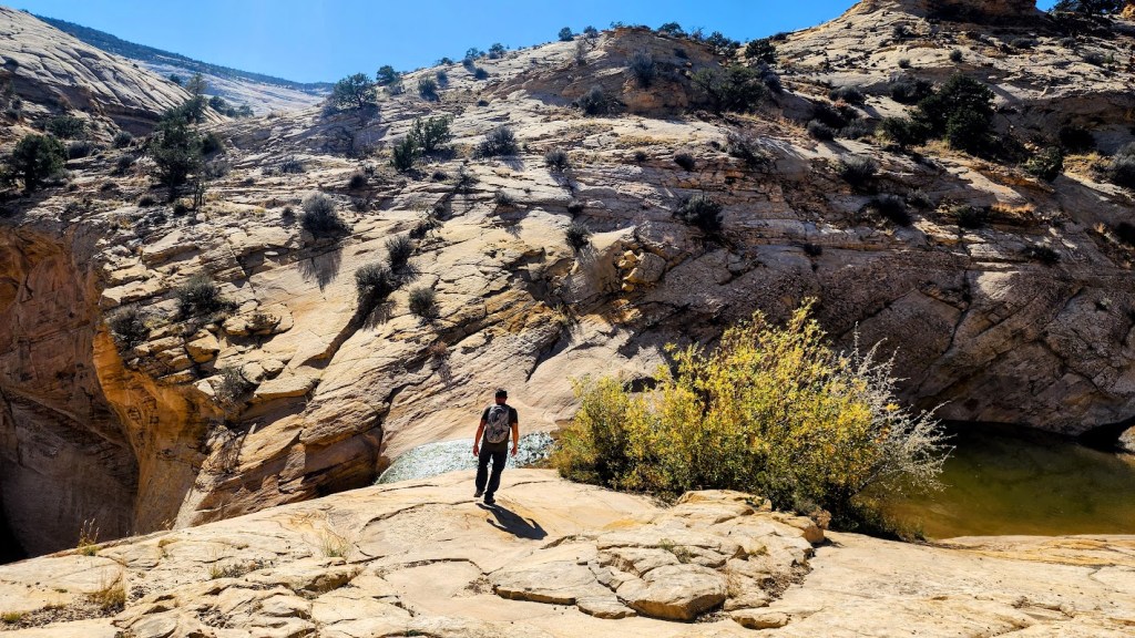
Short, steep, and super sweet waterfall and pools hike. The upper sister to Lower Calf Creek Falls— both doable in a day if you’re into chasing waterfalls and plunging into icy pools.
Elevation gain/loss ~600ft (per alltrails), 1,476ft (per Garmin) – uh, idk, split the difference? (Felt like more than 600ft and less than 1,400.) Let me know what elevation reading you get.
Miles: 2-3 RT, depending on how much you wander and explore.
Difficulty: Easyish, depending upon knee health and fitness level—Starts and ends with a half mile of steep slickrock descent and ascent, respectively – daunting to many – all the better for the few.
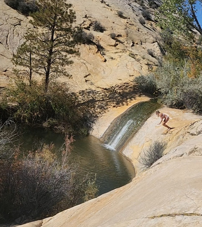
Highlights: Dramatic Navajo Sandstone slickrock landscape with expansive vistas, an 87-foot-high waterfall, and a couple cool (in more ways than 1) pools set in a shady riparian oasis.
Getting there is half the fun: The trailhead is 22.4 miles NE of Escalante between mileposts 81 and 82 off of UT-12, which is one of the most beautiful scenic byways in Utah, and many would argue in the entire US. Parking is free.
Post Hike Rewards at Escalante Outfitters—their Pizza is the Best!!!
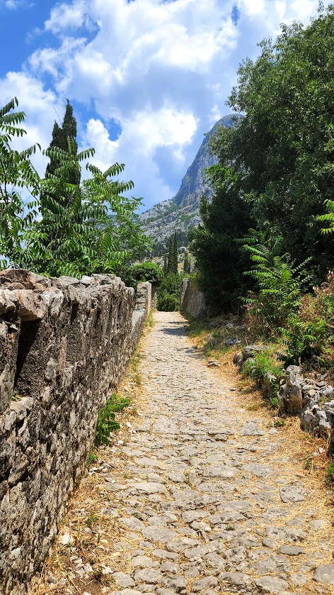
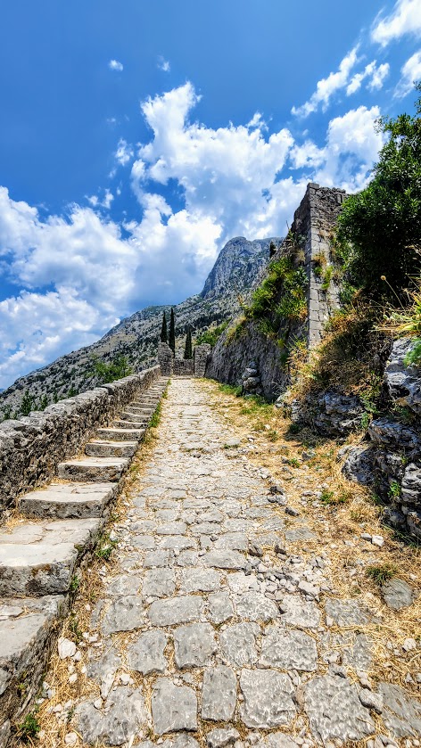
Difficulty: Moderate, depends on your fitness level and the heat—gradual and short, but persistent incline of almost 1k ft in 1.5 miles via stone stairs, concrete, and dirt paths
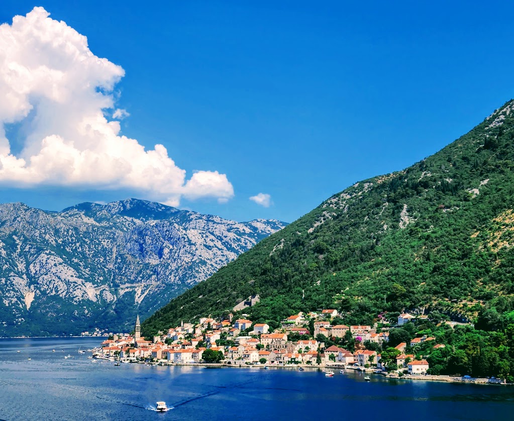
The names Kotor and Montenegro just sound cool don’t they? I anticipated that this might be one of my favorite stops on my RC Mediterranean cruise and it was.
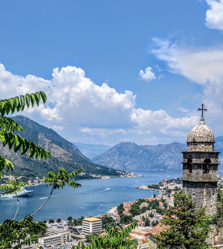
Kotor is a charming coastal village in the country of Montenegro (translated black mountain). It is located on the Adriatic Sea in the Bay of Kotor and part of the Balkans. Montenegro is bordered by Serbia, Bosnia and Herzegovina, Kosovo, Albania and Croatia. The population of Kotor is ~13,510.
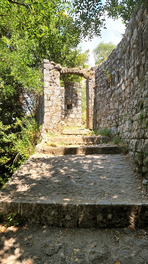
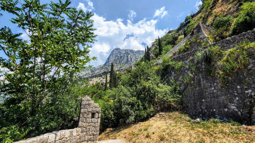
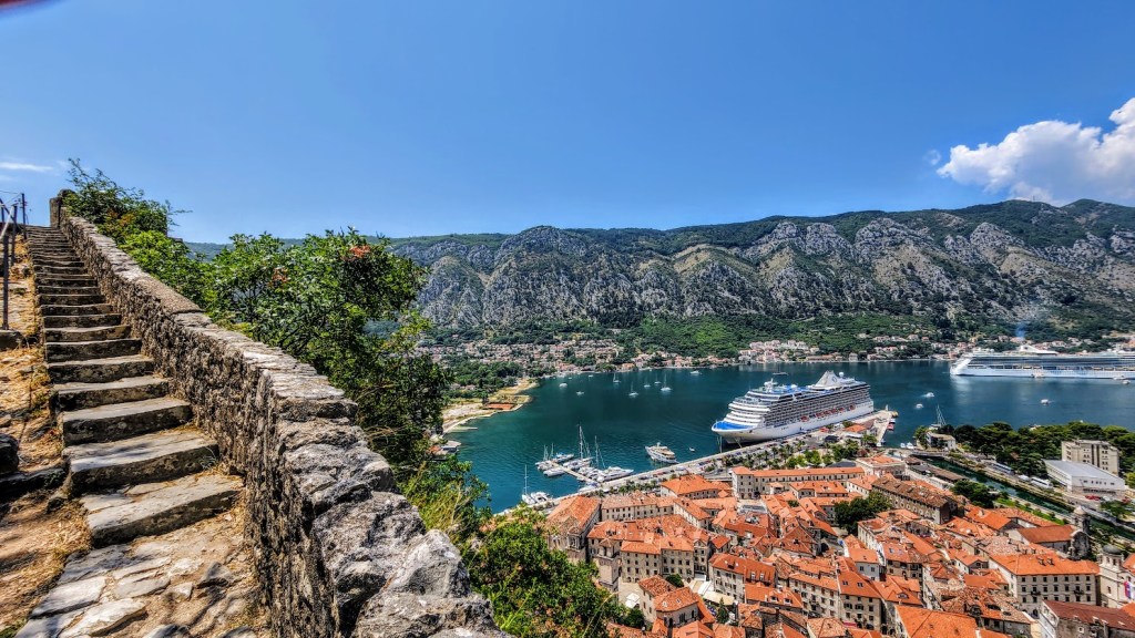
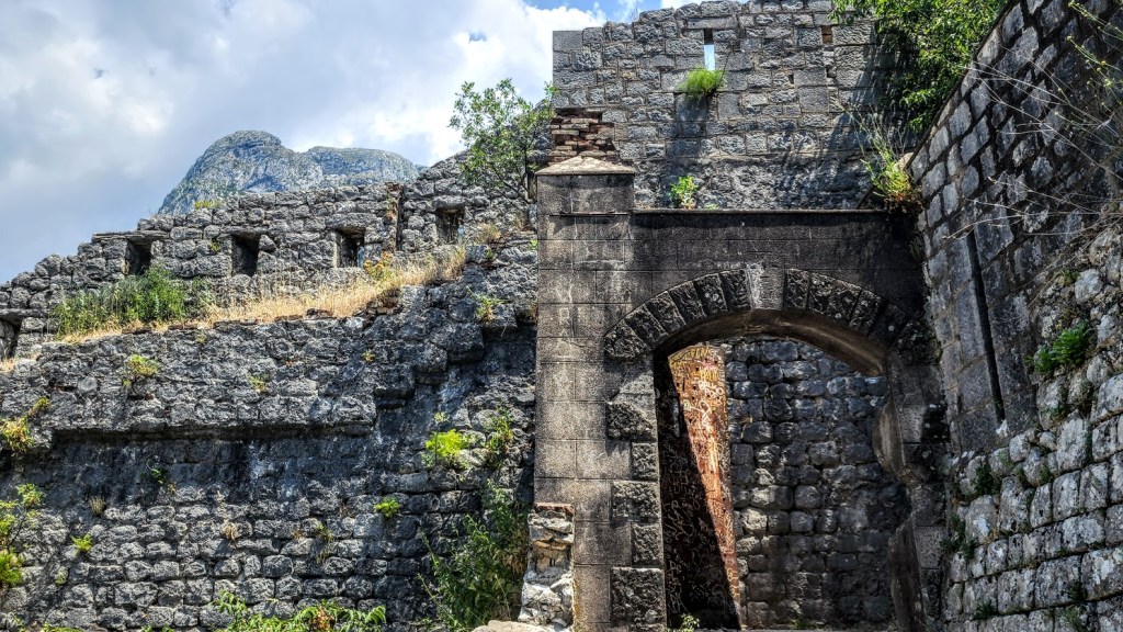
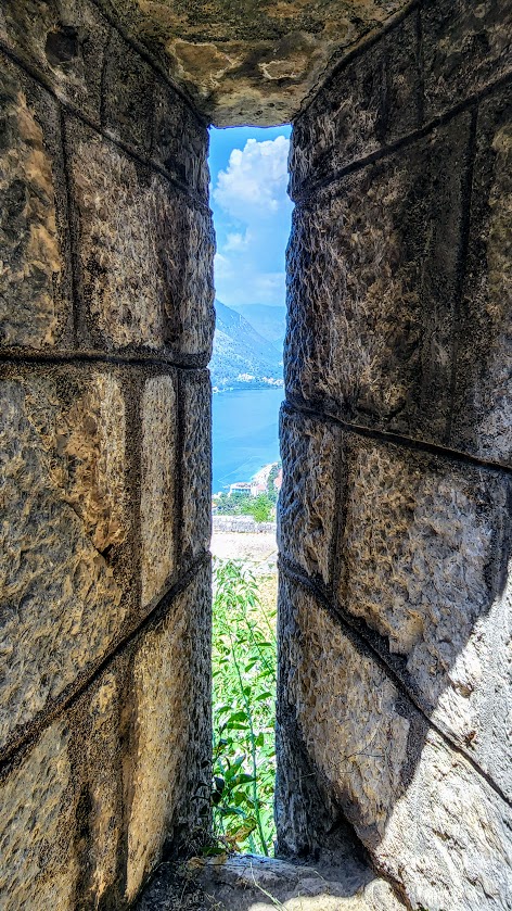
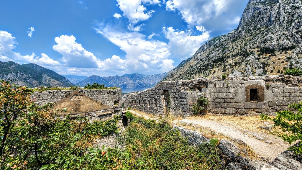
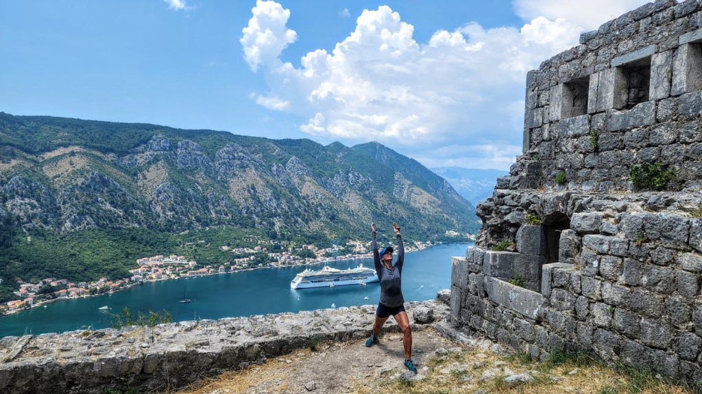
The ancient Mediterranean Port of Kotor is surrounded by fortifications dating back to the Venetian period. Old town Kotor and its fortress nestled up high in the spectacular limestone cliffs are listed as a UNESCO World Heritage Site. Three major earthquakes in the last 500 years (the most recent in 1979) have taken their toll on the fortress, but enough remains of the remains to capture the imagination. One of the coolest things to do in Kotor is to hike up to the Kotor Fortress. Spectacular views of the old town and bay below will captivate you on your journey up and down what some locals refer to as the 1,000 stone step death march.
Return by way of Kotor’s old town to enjoy refreshments at any one of the charming cafes and browse the unique shops.
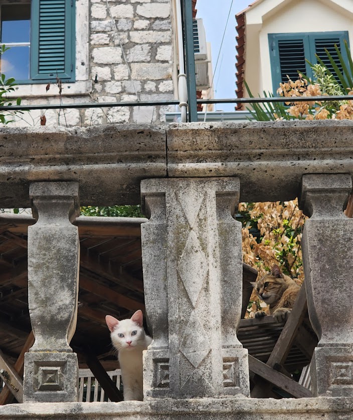
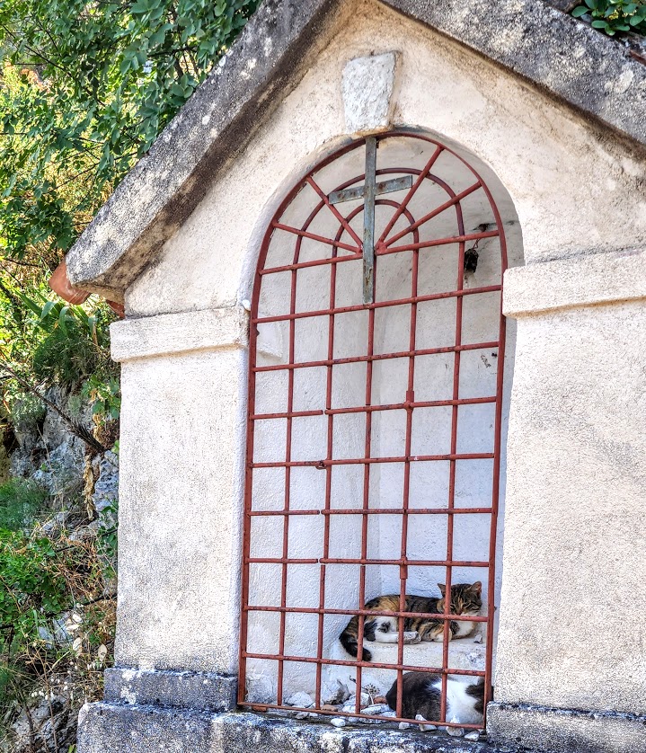
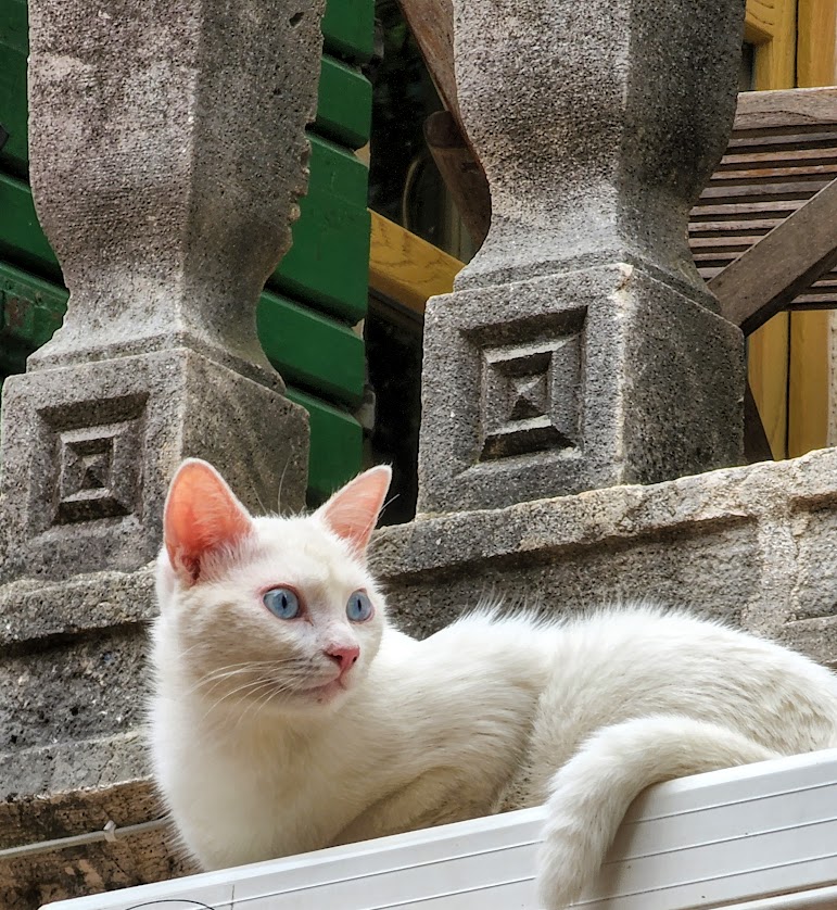
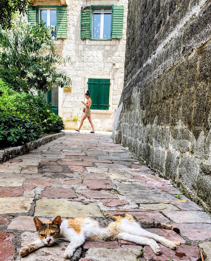
Kotor is also known for its free-range cats, some obviously living better lives than others.
Notes: The hike is completely exposed and entirely uphill on stairs, concrete, and dirt. Temperatures can be hot in the summer. Fee: ~8 euros, while there’s a back way to hike to the fortress where you can avoid the fee station, it’s nice to contribute to the local economy. (Truth in advertising—unfortunately, you will see trash and graffiti along the way. One would hope that our fees would be enough to pay the teenage “gatekeepers” to keep the grounds clean, but apparently not.
Happy Trails!
Warrior 1 at the Fortress, the cruise ship photobombing in the background
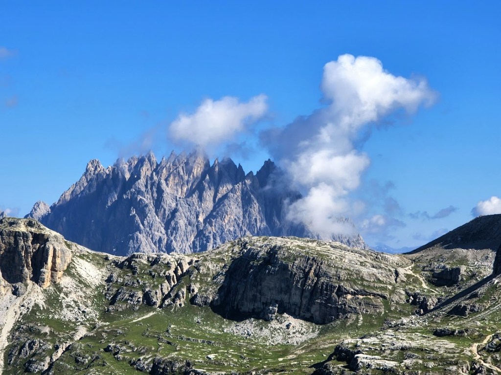
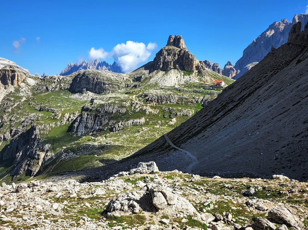
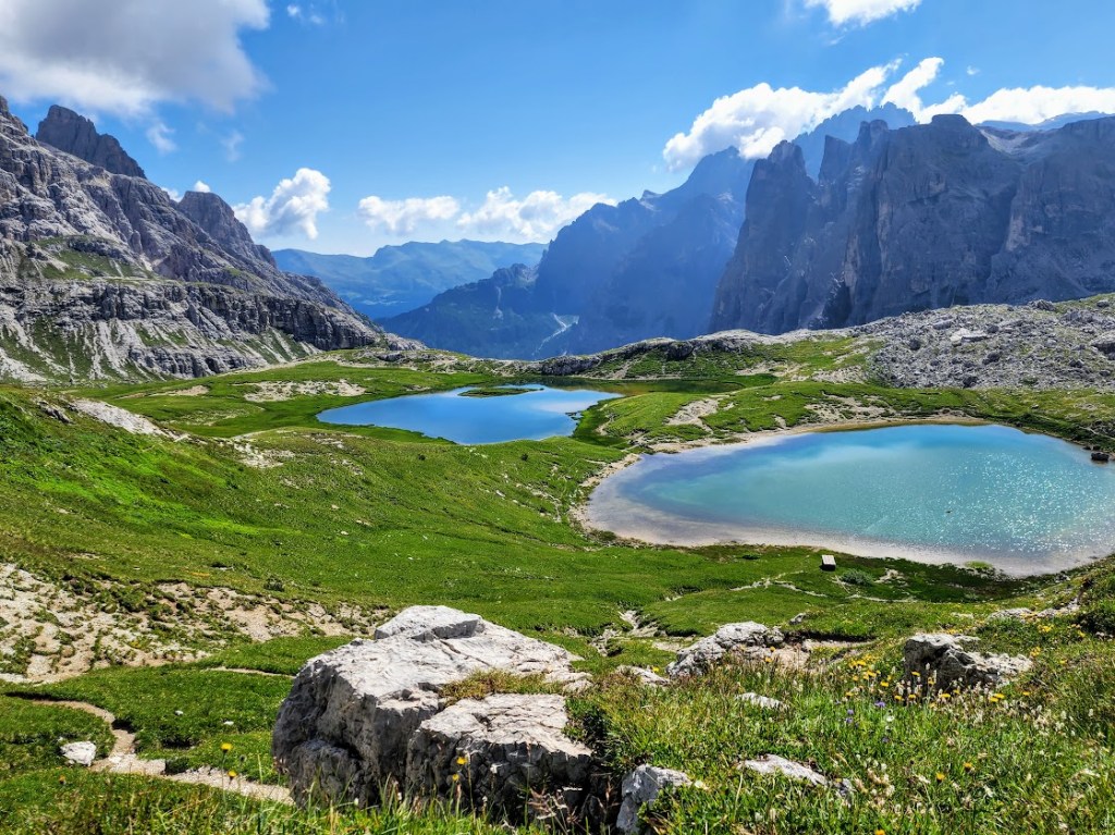
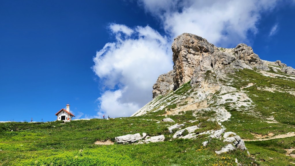
The Tre Cime (3 Peaks ) of Laveredo hike is a peak Dolomite experience. A spellbinding journey in the Alps from start to finish. There’s so much beauty packed into this short loop—much more than the 3 peaks themselves. There are the jagged limestone crests crowning the expansive panoramic mountain views, the turquoise alpine lakes, and of course, there are the rifugios (3 to go with 3 peaks). It’s easy to see why this hike is among the most popular in the Dolomites.
Distance: 6.75-mile loop, begins at Rifugio Auronzo, Path 101
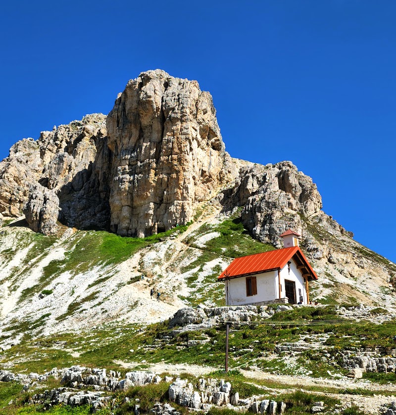
Rifugio Auronzo
Difficulty: Moderate, depending on fitness level and acclimation to the altitude of 9,839 ft. A mix of up, down, and flats with some solid incline in relatively short mileage. The terrain on the main, wide path is easy—running shoes will do.
Elevation gain: ~2,247 ft
Startingelevation: ~9,839 ft
Sublime, except for the crowds, which are hard to avoid even if you arrive when the parking entrance opens at 8 AM. (There’s a line of cars by 8:15 AM.) However, you can try to outpace the crowds or take one of the more challenging, less-traveled single-track trails that run high above and parallel to the main trail.)
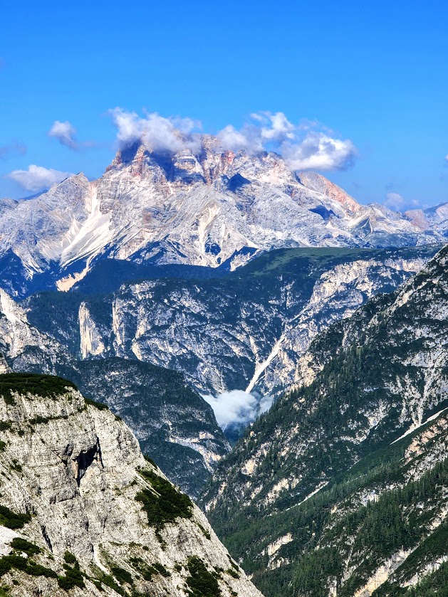
We stopped at the halfway point, Rifugio Locatelli / Drei Zinnen hut, to take in the views of the 3 peaks. I made the best of the puddle reflection photo ops before sauntering down to lakes to soak it all in.
The panoramic views by the lake were dazzling. (Apologies for the dizzy spin.)
At one point, I thought I was having high-altitude auditory hallucinations, the melody of Amazing Grace playing in my head and wafting through the alpine air. It turns out I wasn’t hallucinating. A couple of fellows had brought their bagpipes with them on their hike. Their pro bono concert was short and sweet, with the added excitement of a near fist-to-fist altercation between 2 octogenarian photographers (one Italian, one German?) – one blocking the view and photos of the other and all of us for no apparent reason other than to be objectionable. (Perhaps an Italian vs German thing – apparently there’s still friction between the nationalities that dates back to WW1, continued through WW2, and still exists today—especially in this area of the South Tyrol.) Here’s an interesting article on the long journey to reconciliation.
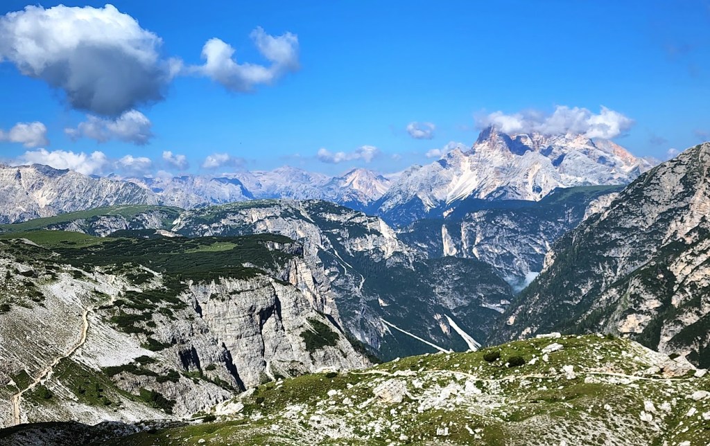
After the “concert”, we dropped down into the valley and climbed across the ridge underneath the 3 peaks.
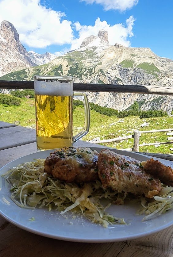
We stopped at the Malga Langalm hut to enjoy a hearty lunch in the splendid Alpine wildflower-sprinkled meadow. The Rifugio Locatelli visible in the far distance made it seem like we’d hiked much further than we had.
Sadly, our time in the Dolomites had come to an end. We’d been lucky to do 2 of what many call the top hikes in the area. Both Seceda and Tre Cime rank #1 in my lifetime hikes. The Alps have my heart. It’s not Arrivederci, it’s Ci Vediamo Presto! We’ll See Each Other Soon!
Happy Trails!
Directions: 40 minutes from Cortina d’Ampezzo. Trail begins at Rifugio Auronzo, Path 101.
Notes: €30 entrance fee for parking. Open late May through late October 8 AM-6 PM. Rifugios are open from late June through September. No camping is allowed in the park. For the best views, take the trail counter-clockwise. (Keep the 3 peaks on your left side.)
Hands-down one of the most magnificent places I’ve ever hiked!
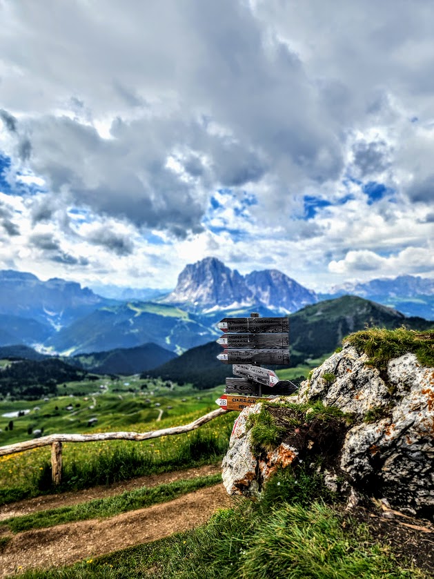
I’ve always dreamed of hiking hut to hut in the Alps, literally dreamt of being on the trail and seeing those iconic sign posts. Well, my dream finally came true.
Preamble: While Italy and the Dolomites were never on “my list” per se, they were how my dream came true. In my life’s journey, I’m learning to surrender control and go with the flow, and I’m discovering that’s where life’s best rewards are. So, of course, when I find myself in a fate-directed destination (Italy), you can bet that I will carpe diem and sneak in a dreamy adventure or 2 when I can.
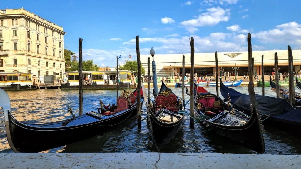
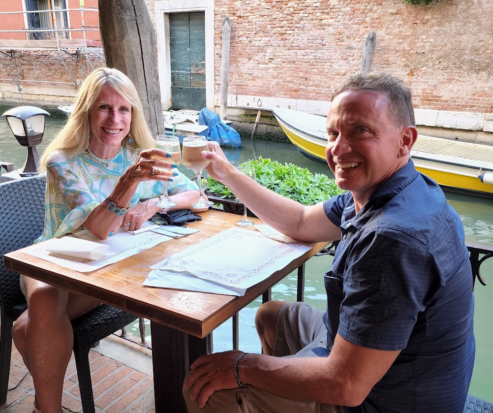
Backstory: I was in Venice to surprise my sister by “crashing” their cruise. Cruise, you say, that doesn’t sound like your kind of thing. True, but family time is family time, and you take it when you can get it. I’d surprised her a couple of years ago on a cruise, and when covid hit, it hit me how much I treasured that week. So I did it again. And surprisingly, she was surprised again. More on the fabulous cruise destinations later.
I bribed myself and my boyfriend into the cruise by giving ourselves the gift of a couple of days of hiking in the Dolomites. The beauty of the Dolomites is absolutely dazzling and dizzying. I’m supposed to be a writer, but I can’t even begin to do it justice with words. So I’ll let the pictures do the talking for me.
Here’s the scoop
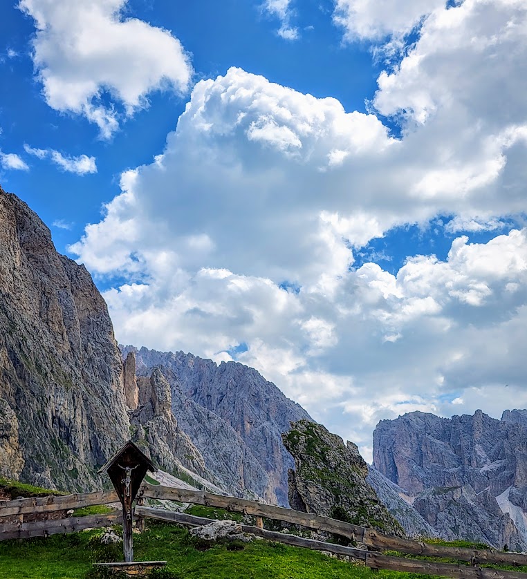
Located in the Puez-Odle Nature Park, the spectacular Seceda ridgeline carves the rugged silhouette of the Fermeda Towers against the sky high above the charming villages of Ortisei, St. Christina, and Selva in the Dolomites.
Considered South Tyrol, this area is located in the northern part of Italy and bordered by Austria to the North (Tyrol) and East (Salzburg). It’s less than a 3-hour windy drive from the Venice airport.
A Little History: The autonomous Italian province of South Tyrol was created in 1948 when Italy annexed it following the defeat of the Central Powers / Central Empires (German Empire, Austria-Hungary, the Ottoman Empire, and the Kingdom of Bulgaria) in World War I. From 1814 to 1919, Tyrol was part of the Austrian Empire. And before that – well, you know how European history goes…
Today, the Austrian influence in the area remains strong, with 70% German and 25% Italian speakers. Okay, so what about the hike, you ask? Well, I’m getting to it.
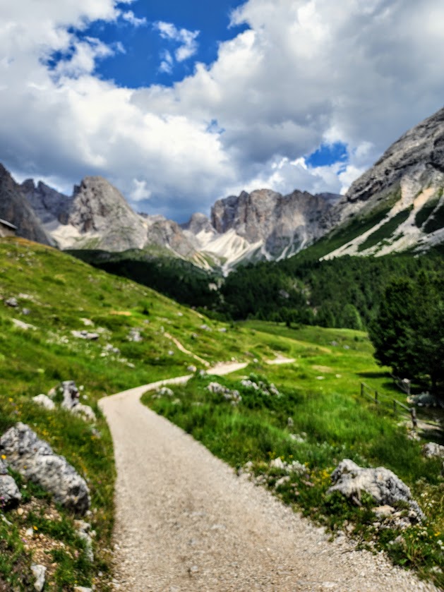
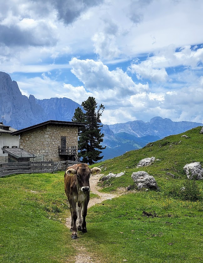
We took the Ortisei-furnes Gondolo and the Fummes-Seceda Cable Car to the summit and started our hike there. We stopped for refreshments at our first rifugio (translated as refuge/shelter /haven) before we hit our second mile. A young, handsome boy wearing traditional German lederhosen served our giant size charcuterie feast . The cheese was handmade by his family, and courtesy of their free-range cattle, the bread was baked fresh that morning. (Warning, weight can happen while hiking here.)
And yes, we stopped at another rifugio and had another “little snack” with a charming Italian couple from Milan who shared their trail map and helped keep us on the right path. From there, we took the St. Jakob Church trail that eventually meandered back down to the village of Ortesei. The route we chose was 12 miles with a moderate ~1,453 feet elevation gain.
Latte with a lovely viewA little snack of fresh bread, cheese, spec, and a pickleNice spot for a picnic, eh?
The mesmerizing soundtrack of the Alps is birdsong mixed with the clang of cowbells and church bells.
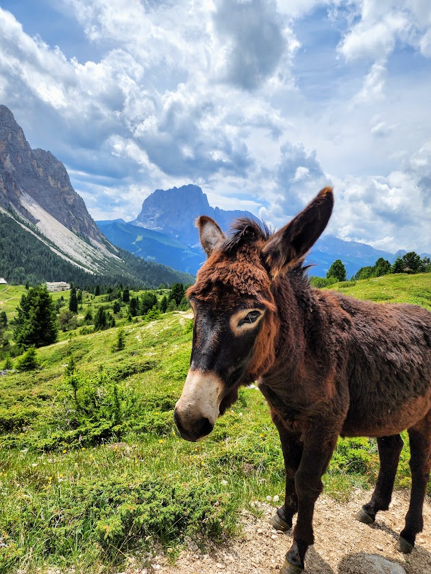
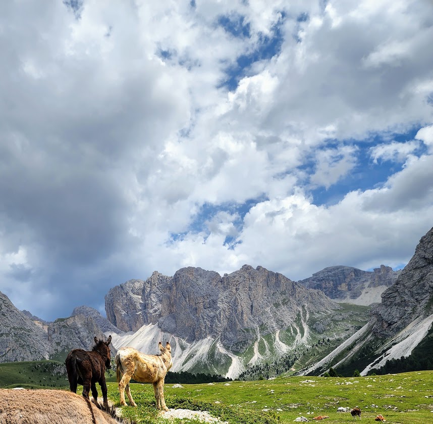
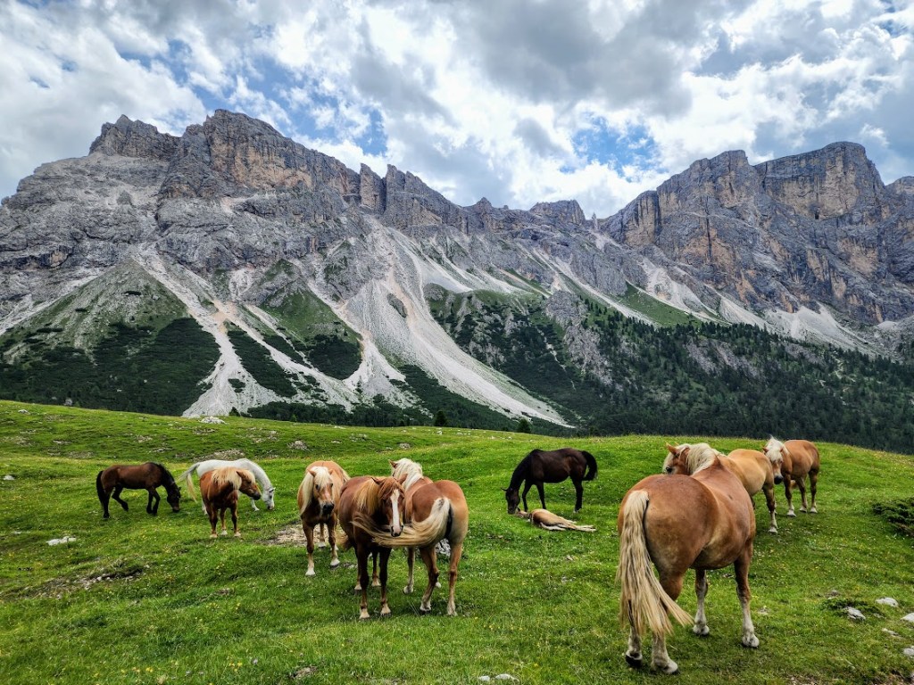
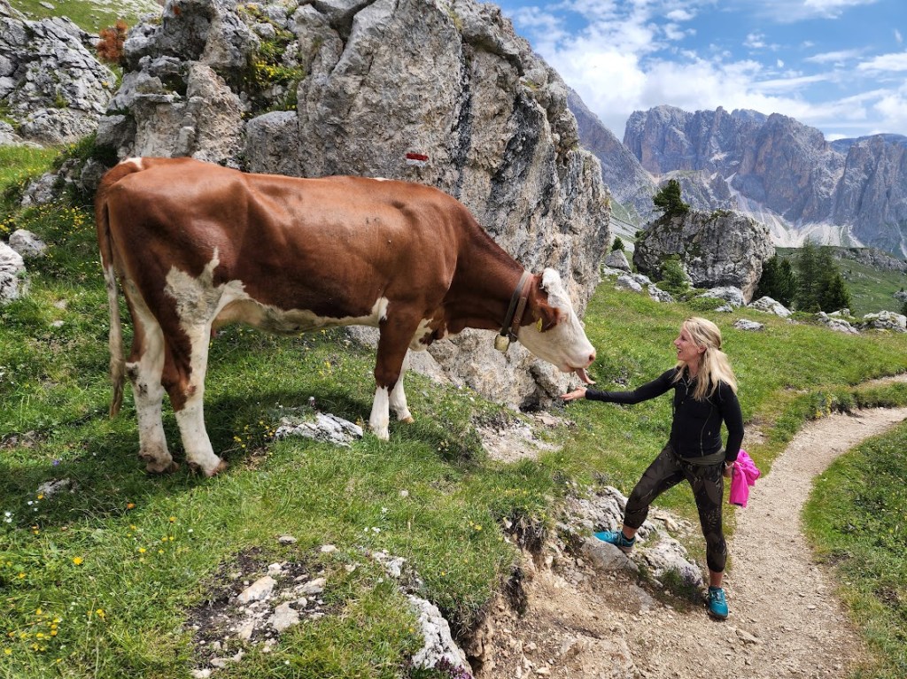
Don’t be surprised if you find yourself singing or humming the Sound of Music soundtrack as you make friends along the trail with various cows, horses, donkeys, and chickens.
Getting there: ~3-hour drive to the village of Ortisei from Venice Airport
Notes: Unless you have plenty of time to spare and are game for gratuitous elevation gain, you’ll want to take the Ortisei-furnes Gondolo and the Fummes-Seceda Cable Car. This strategy will give you ample time to explore the many trails off the summits, which naturally have the best views. The cable car and gondolas run from 8:30 AM to 5 PM, early June through mid-October. The elevation at the top is 8,200 feet so if you’re sensitive to altitude, you may want to take a some time to acclimate.
You can purchase 1-way tickets for ~$30 or roundtrip tickets if you don’t want to hike all the way down back to town. (If you are hiking for more than 1 day, consider purchasing the Gardena Card, which provides unlimited use of specific cable cars and gondolas.) Once at the top, you can choose your own adventure to fit your fitness level and interest. The main trails are well marked, and the terrain is relatively easy. A combination of altitude, incline, and duration can be challenging—know your limitations, but also know that there are plenty of opportunities to take breaks and refuel along the way. You MUST stop at the huts for the local experience and fresh-baked bread, homemade cheese, and savory sausages. Running shoes worked for me this time, but poles and hiking boots are always a good idea.
As with most popular spots, get there early to avoid the crowds.
Stay tuned for the next post on spectacular Tres Cime.